Contributed by Larry Franks, Operation Manager, Reservoir Engineer
Magellan Petroleum Australia Limited
The Engineer
Larry Franks works for Magellan Petroleum in Australia. He manages petroleum production operations and also does hands-on engineering for drilling and exploration operations. His job includes the design and drilling of the exploration wells, gas reserves analysis, facility design, and product sales. In short he performs a wide variety of jobs focused on the upstream petroleum industry (drilling and production of oil and gas versus refining it into petrol and other products).

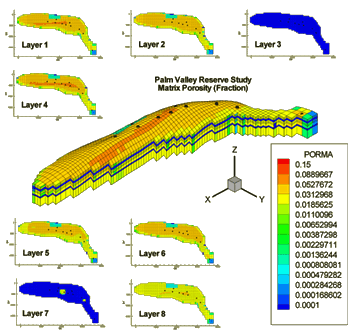
Figure 1: Rock porosity in the Palm Valley Gas Reservoir. The data is input to the reservoir simulation.
The Reservoir
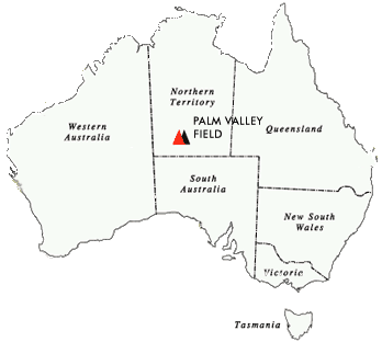
The Palm Valley gas field is located approximately 120 kilometers west of Alice Springs in Australia’s Northern Territory. The field has been in production since 1983, providing gas for electricity in the towns of Darwin and Alice Springs.

Palm Valley produced 6.4 Bcf (billion cubic feet) of gas in 2002, and the same amount in 2001. Compression is used to counteract the natural decline, maintaining the production level.
Palm Valley produced 6.4 Bcf (billion cubic feet) of gas in 2002, and the same amount in 2001. Compression is used to counteract the natural decline, maintaining the production level.
The Reservoir Simulation
Using a finite-difference petroleum reservoir model called TETRAD, Larry quantifies gas reserves in the reservoir and predicts future gas and water production.
Surface geology studies and seismic data create the three-dimensional shape of the reservoir – consisting of 50,000 grid blocks in the simulation.
Input variables for the model include the latest production data, as well as subsurface geologic data gathered from ten wells drilled into the reservoir.
Three to four hundred time segments are ran producing hundreds of pages of data. “It is impossible to understand the data unless it is in graphical form,” Larry added.
Tecplot
Tecplot is used to display the geological data, as well as the simulation results. Larry wrote a QuickBasic program converting the input and output data from the simulator to Tecplot.
“For every layer we include data for each geologic property, like porosity. With this much detail it is difficult to form an image of the reservoir without 3-D plots. The images from Tecplot provide an instant picture of the whole reservoir and its features – which is extremely informative,” said Larry “Tecplot was straightforward – the features I needed were covered in the manuals. I was impressed that Tecplot animates simulator data with hundreds of time segments and runs them like a video.”

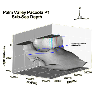
Figure 2: Regional surface plot in the Palm Valley. This region is called Pacoota. Rocks are usually divided into units based on geologic age and named by the geologists that first define the rocks.


